
SDU Tools: Calculate week day of the month in SQL Server T-SQL
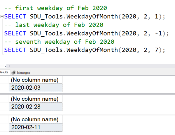
The DateDiffNoWeekends tool in our free SDU Tools for developers and DBAs, has been really popular. Another request that we received though, was how to calculate which date a particular numbers week day is. For example, we might want to know which is the 12th week day of the month. So we’ve added a tool to do that. It’s called WeekDayOfMonth.
It’s a function that takes three parameters:
@Year is the year (of the month in question) @Month is month in question (as a number within a calendar year i.e. March = 3) @WeekdayNumber is an integer that gives you the position in the month that you are trying to calculate.
2020-02-26